
In the late 19th century, a feverish wave of migration swept toward the Western frontier. While the transcontinental railroad brought settlers to the edge of the plains, the tracks only went so far. To bridge the gap between the railheads and the remote “boom towns” of Southeast Colorado, a vital network of stagecoach lines emerged.
As described in the Fowler City Graphic on December 30, 1886, settlers were bound for the “praised loaded land of eastern Colorado,” not wishing to be “left entirely behind by the star of the empire on its Western course”.
Here is the story of the men and machines that connected the “New Western Eldorado” to the rest of the world, told through the newspapers of the day.
The Language of the Road
Before diving into the specific lines, one must understand the reality of “staging.” While we often romanticize the era, the terminology used at the time reveals a rougher existence.
The concept of the “flying coach” goes back at least to the late 1600s when there were advertisements in the newspapers , such as the ones shown below for journeys being undertaken in these “flying coaches.”

In the American colonies, some time before the American revolution, sometime around 1740, crude wagons were used to carry passengers between cities and towns in New England. By the 1750s there were regularly scheduled stage routes between New York and Philadelphia. Travel time was reduced on this later run from three days to two in 1766 with an improved coach called, of course, “the Flying Machine.”
The first mail coaches appeared in the later 18th century carrying passengers and the mail, replacing the earlier post riders on the main roads. Coachmen carried letters, packages, and money, often transacting business or delivering messages for their customers.

By 1829 Boston, MA was the hub of 77 stagecoach lines; by 1832 there were 106. Early stagecoaches were known for their rough rides.Coaches with iron or steel springs were uncomfortable and had short useful lives. It wasn’t until 1820s that a major improvement arrived with the Concord coach. Two men in Concord, New Hampshire, developed what became a popular solution. They built their first Concord stagecoach in 1827 employing long leather straps under their stagecoaches which gave a swinging motion. This stagecoach became the premier model and is what we think of arriving and leaving in the old west town in western movies.
The term “riding shotgun”—now a casual claim for the front seat—was a literal necessity. It originated from the “shotgun messenger” who sat armed with a coach gun beside the driver to protect mail and passengers.

(Portland, Maine) 5 Jun 1821.
The vehicles themselves were marvels of their time, particularly the Concord Coach. Unlike earlier wagons with rigid iron springs that jarred passengers’ bones, the Concord used leather “thoroughbraces” to create a swaying motion. Mark Twain, in his book Roughing It, famously described this as a “cradle on wheels”.
However, the “cradle” was often uncomfortable. In 1880, traveler John Pleasant Gray described the reality of a packed coach:
“Jammed like sardines on the hard seats of an old time leather spring coach… creeping much of the way, letting the horses walk, through miles of alkali dust that the wheels rolled up in thick clouds… If it had not been for the long stretches when the horses had to walk, enabling most of us to get out and ‘foot it’ as a relaxation, it seems as if we could never have survived the trip”.
Stage Routes of Southeastern Colorado
A pivotal resource for visualizing the region’s early transportation network is the map created by Sam Konkel, which was originally published in the Springfield Democrat Herald on January 8, 1915,. Designed to provide a visual of the stage and proposed railroads of the 1886-1889 time frame.

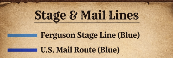
We have created a modified version of this map with a distinct color-coded system to trace these vital arteries of Southeast Colorado which extended into Kansas and the Neutral Strip,. The Blue Line identifies the dominant Ferguson Stage Line and U.S. Mail route, running south from Lamar, Colorado through Wilde to Springfield and Vilas. The Red Line marks the Tornado Hack Line, providing the essential connection between the Boston, Colorado and the Kansas towns of Richfield and Frisco,. Orange identifies the Mineral State Line that goes into Mineral City in the Neutral Strip and Grey shows the early Crill and Bowdle Stage Line. We have also included Yellow Lines to depict the various railroads proposed during the boom era; however, historical accounts suggest Konkel’s memory was somewhat “sketchy” regarding these routes, as he omitted several known proposals despite his personal attendance at many of the original planning meetings. We also have several closeups to help see the details.

Below are some detailed maps adapted from the one above with several closeups:


The Southeast Colorado Stage CoachPioneers: Crill & Bowdle
Before other mail contractors arrived, smaller operators blazed the trails. The Crill and Bowdle Stage Line is recognized as the first to serve what is now Baca County. Running during the winter boom of 1886–1889, they connected Butte City to Granada.

Although they are not names, this news clipping, appearing in the Garden City Daily Herald on August 20, 1886, likely provides evidence of their early operations

“Daily stage line has been established between Coolidge, Butte City, in Las Animas county, and Lamar, in Bent county Colorado”.
The Kansas Connection: The Tornado Hack Line between Boston, Colorado and Richfield, Kansas
By 1887, the town boom was accelerating, and Southeast Colorado relied heavily on connections to Kansas. The Tornado Hack Line (indicated as the “Red Line” on early stage maps) provided a critical link between Richfield, Kansas, and the town of Boston, Colorado. This line was closely tied to local commerce; one of its proprietors, B.F. Gumm, also operated the Boston Colorado Hotel.

This line was vital for commerce. As noted in the Richfield Leader-Democrat in July 1887, the demand was so high that the line had to upgrade its schedule:
“The line had transitioned from tri-weekly to daily service to keep pace with the influx of settlers”.

A traveler writing for the Fowler City Graphic in December 1886 described the journey south of the Arkansas River on a similar route, painting a vivid picture of the terrain:
“Taking the ‘O.K.’ stage line south, we were soon among the interminable sands south of the Arkansas river… Some six miles south of Syracuse we passed the boundary lines of the sand hills and rolled out upon a beautiful upland prairie which extended with constantly increasing beauty until Richfield was reached about sunset”.

The Titan of the Plains Stagecoach Companies: Calvin Ferguson
While smaller lines were essential, the dominant force in the region was the Calvin Ferguson Stage Lines. Headquartered in Winfield, Kansas, Calvin Ferguson and his brother Wes were the “Stagecoach Titans of the Plains.”
Ferguson was a U.S. mail contractor with a reach extending across Kansas, Indian Territory, New Mexico, and Colorado. His “Blue Line” (as marked on historic maps) was the backbone of the region, in Southeast Colorado he ran essential mail routes between Lamar, Springfield, and Vilas. The headquarters of the Ferguson operation was in Winfield, Kansas. We learn more from The Winfield Courier, (Winfield Kanas) Supplemental Edition March 14, 1901.

It appears that Ferguson partnered with different entities on his stage routes. In a December 27 1934 article in the Springfield Democrat Herald, early Settler J. A. Oxenreider wrote,
“There was no post office at that time. Ferguson and Silver ran a stage line from Lamar and they brought the mail in a sack and it was dumped out on the floor and people had to sort out their own mail but that did not last long.
In another new clipping Ferguson (not sure whether they are referencing Calvin or Wes) are partnered up with someone named Harris in a company called the Bee Line stage Company.
The Man Behind the Empire
Calvin Ferguson was a seasoned frontiersman. A Winfield (Kansas) Courier profile from March 14, 1901, details his life:
Calvin Ferguson was born in Butler County Pennsylvania. The age of 12 years old he moved with his parents to Lawrenceburg, Indiana, making the journey by Steamboat on the Ohio River. Then from Lawrenceburg he moved to Galatian County Kentucky, where his mother still resides. In Pennsylvania his father was a railroad contractor, he having built the first railroad through the county in which you live. When a boy of 17, Calvin enlisted in the 54th Indiana regiment for a service of ninety days. The service was rendered in the states of Kentucky and Tennessee, when the regiment was mustered out. Mr Ferguson then went on a steamboat here government stores Fort Leavenworth; later he followed steamboating on the Mississippi, Ohio and Missouri Rivers, is an occupation till 1871, when he came to Baxter Springs Kansas, where he was married to miss Ellen Chittenden. He soon remove to Winfield engaged and delivery and state business since his residence here is taking an active interest in building up the town, and many Enterprises

“During the early days in Oklahoma Indian Territory Ferguson had some of the wildest and most exciting experiences on different routes, his stages often being held up by robbers and outlaws who made that country their hiding place”.
By the time he reached Colorado, he offered extensive stage services across the region.. The Winfield Tribune (August 4, 1888) noted how mining discoveries near Carriso would impact his business:
“Our townsman, Mr. C. Ferguson, will no doubt find his mail and hack line, running from Lamar to Springfield and thence to Carriso, taxed to its full capacity to accommodate the people who will go to investigate the new discovery”.
His operations weren’t always seamless. Early Baca County settler J.A. Oxenreider recalled the chaotic early days of mail delivery in a 1934 article:

“Ferguson and Silver ran a stage line from Lamar and they brought the mail in a sack and it was dumped out on the floor and people had to sort out their own mail but that did not last long”.
The End of the Line
The stagecoach era began to decline in the late 1800s as new technologies emerged. The first automobiles were invented in the 1880s, and by the early 1900s, they had begun to replace stagecoaches as the primary mode of transportation in the West. At first, automobiles were expensive and unreliable, and many people still relied on stagecoaches to get around. But as automobiles became more affordable and more reliable, they began to supplant the stagecoach.
The transition from stagecoaches to automobiles was not without its challenges. The roads of the West were often unpaved and poorly maintained, and early automobiles struggled to navigate these rough conditions. In some cases, new roads had to be built to accommodate automobiles, which required significant investment and effort. But despite these challenges, the automobile ultimately proved to be a more efficient and convenient mode of transportation than the stagecoach.
Today, the legacy of the stagecoach era can still be seen in the American West. Many towns and cities have preserved their historic stagecoach stations and routes, and tourists can still take stagecoach rides in some areas.

Reflecting on the passing of this era, the Boston (Massachusetts) Evening Transcript wrote on April 14, 1900:
“Ah, what a welcome to lonely roads, to scattered farm houses, to isolated hamlets, this flying wonder! Its cheery rattle, the music of those nimble horses hoofs meant civilization, commerce, a new world”.
By the early 20th century, the Ferguson Stage Lines and their competitors had ceased operations. The boom towns they served either found the railroad or faded into ghost towns. Yet, for a few dusty, frantic decades, these coaches were the only thread connecting the isolated pioneers of Southeast Colorado to the rest of the nation.
Help support our work: Check out these titles on Amazon:


The Area
This map, titled “1886-1889: The Boom Town Years,” provides a historical snapshot of the rapid settlement across the High Plains, specifically where the borders of Colorado, Kansas, New Mexico, and the Oklahoma Panhandle (then known as the Neutral Strip or No Man’s Land) converge. We attempted to depicts a region teeming with speculative growth, capturing a brief window of time when the promise of railroads and land claims drew thousands of settlers to the frontier. Geographically, the highest density of activity is concentrated in Southeast Colorado and Southwest Kansas, with many settlements like Brookfield, Atlanta, and Richfield appearing as hopeful hubs of commerce.
In total, the map identifies approximately 45 to 50 distinct towns scattered across these four territories. A striking feature of the map is the recurrence of famous Eastern city names—such as Atlanta, Albany Boston, Cleveland, Indianapolis, and Springfield—which were often chosen by developers to lend an air of established prestige to these fledgling outposts. While the map shows a bustling landscape, it serves as a “before” picture for the region; many of these locations, such as Beer City or Woodsdale, eventually became ghost towns or vanished entirely after the “boom” subsided as they lost the county seat competition or did not get a railroad.

Leave a Reply
You must be logged in to post a comment.